This post was created by Triple F.A.T. Goose, an outerwear brand that Travel and Leisure magazine named as a top pick and said, "This is the best goose down winter coat I’ve ever worn" when describing Triple F.A.T. Goose down coats.
A good hike is one of our favorite activities, no matter the weather. But summer is a great time to get out and explore nature – especially if there’s a waterfall or swimming hole to be found. Start working through the list now and it will carry you right into fall where you can marvel at the beauty of the changing autumn leaves.
Harriman State Park
This park boasts over 200 miles of hiking trails, and if you don’t have a car you can get there from Port Authority in NYC. Just hop on the Shortline Bus and get off in Southfields, NY, where you can pick up the Appalachian trail. Once inside the park you can choose from over 40 marked trails that lead you through coastal forests surrounded by dozens of wildlife species. There are 31 lakes within the park, many of which allow swimming. There are also numerous designated camping sites throughout the park, including several historic lean-tos where overnight stays are allowed. You can even camp in a cave!
Delaware Water Gap Recreation Area
If you really want to get out of the city, head over to the Mt. Minsi sector of the Delaware Water Gap Recreation Area. The Appalachian Trail serves as the main trail for the area, but we’re sending you to find the waterfall that lies on one of the smaller connecting trails off of Old Mine Road. The Old Mine Road itself is a historic gem lined with beaches, rock ridges, abandoned houses and farms, and an old dam. Check the park’s website for updates before traveling, because parts of Old Mine Road close during the winter. A small section of Mt. Minsi is closed of in the springtime due to peregrine falcon nesting.
Stairway to Heaven
Pochuck Valley to Pinwheel Vista: The Stairway to Heaven is a 2.5-mile hike on large rock steps that zig-zag up the side of Waywayanda Mountain. You can choose to just climb the stairs, or a longer route will take you through 7.4 miles of hardwood forest where you’ll encounter a suspension bridge, flowered fields, and railroad tracks before taking on the steep climb up Waywayanda Mountain. At the top is Pinwheel Vista, one of the best views in NJ.
Ramapo Mountain State Forest
This extensive network of trails allows you to customize your hike, with something interesting to see no matter where you go. The most popular place to visit lies around the lake and the Van Slyke Castle, and the farther you hike away from that area the less crowded it gets. While the hike around the lake is relatively easy, it’s a steep climb up to the castle ruins. Once you reach the ruins, you can go up the nearby water tower to get a glimpse of NYC. The forest is in the middle of a busy area and you will experience road noise and roads along the way.
Learn more about Triple F.A.T. Goose, a brand with a 35 year history that has been featured in Outside, Esquire, Vogue, Elle, Men's Journal, Cosmopolitan, Robb Report, and more. All Triple F.A.T. Goose coats have a fill power rating of 675 and up. Shop the collection.
SHOP TRIPLE F.A.T. GOOSE


Palisades Interstate Park
This NJ park stretches for 12 miles along the shores of the Hudson River, and offers magnificent views of NYC. The park has 30 miles of hiking and ski trails dotted with panoramic overlooks. There are two boat basins, and several shoreside picnic areas. Higher up on the cliffs near the Visitors’ Center there’s a small picnic area tucked underneath the George Washington Bridge, and it’s not uncommon to spot herds of deer grazing there. A great option for getting some fresh air any time of the year.
Anthony’s Nose Hike
This 2.6-mile stretch of the Appalachian Trail is short and steep, promising stunning views of the Hudson Valley. For the first .6 miles, you’re basically climbing a well-maintained rock staircase. Once you get to the top, the trail that leads you to the lookout point at Anthony’s Nose is flat. The overlook is spacious, and with a bit of exploring you’ll find a smaller viewpoint on top of a big rock that’s great for a picnic or a quick nap before heading back down.
Breakneck Ridge Trail
Breakneck Ridge is a mountain with several summits that lies in the East Hudson Highlands along the Hudson River. It got its name for a reason – the 2.4-mile trail involves steep climbs over tricky rock ledges that can be slippery and dangerous, and is recommended for experienced hikers only. As you climb up the summits and dip back into the pine forest you’ll come upon several overlooks with panoramic views of the river and the mountains that lie on the other side. Keep an eye out for Bannerman’s Castle on Pollopei Island and the Newburgh-Beacon bridge.
Cranberry Lake Preserve in Westchester County
The park is near an old dam and mostly surrounded by watershed lands. The serene, 3-mile trail leads you past a waterfall, alongside cliffs and around the scenic Cranberry Lake. The area is rich in history, and on the hike you’ll encounter stone structures built over a century ago.
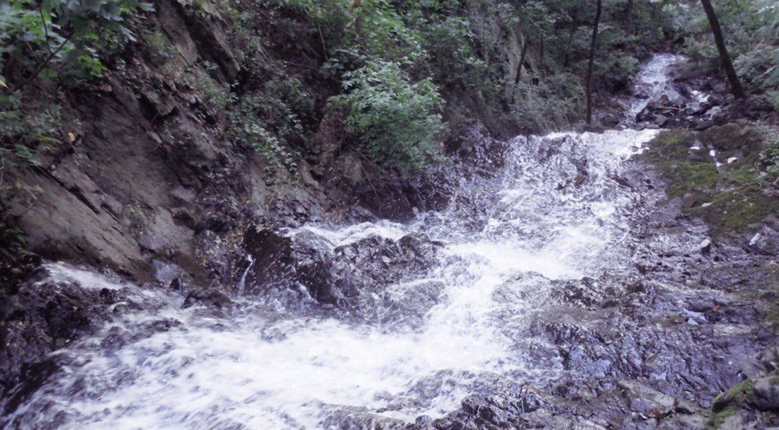
Ice caves & Verkeerderkill Falls
Head to the Shawangunk Mountains if you´re looking for a more strenuous trek. The 7.4-mile trail is moderate to challenging, but worth every step. The mountain´s biodiversity is impressive, and you’ll pass through several kinds deciduous and evergreen forests and stream crossings along the trail. The highlights of the trip include passing through the inner ridges of an ice cave and visiting Verkeerderkill Falls, the biggest waterfall on the mountain. The waterfall is at its fullest during spring and early summer or after a heavy rain. The ice caves are open in the summer when the ice melts. If you’re visiting in early spring check the visitor’s center to see if the ice has melted enough to let hikers pass through.
Tunxis trail
The Tunxis trail is a cluster of 18 rugged trails that cross the western ridge of the central Connecticut valley. It takes you through 9.8 miles of forest, where you´ll pass by colonial-era cemeteries, waterfalls, caves and quiet streams. This is a rocky, challenging hike that will bring you to a lookout point with a view of the reservoir and surrounding mountains.